First Route in the Alaska Range
We made it to Talkeetna last night after a three-hour shuttle from Anchorage. Anchorage was almost as I expected it to be—a little pocket of flat ground on the ocean and surrounded by mountains. In Washington, we joke about learning to appreciate and distinguish the shades of grey, but Anchorage was on another level. It was bleak, but incredibly beautiful. There were trees until the land rose even the slightest—then grey. Even the ocean was grey.
We’re waiting for the weather to clear up in the Range and purchasing last minute gear. Matt and I were persuaded by the climbing ranger to buy overboots. We for sure needed them, he said, “especially in May.” We already had two-layered “double boots”—boots I wouldn’t use again until/unless I go to Antarctica, the Arctic, or high Himalaya. The overboots added a third layer for possible conditions on Denali—like 40 below with additional wind chill. Even though I read on an online forum that you didn’t necessarily need overboots, we got them anyway. Listen to the climbing ranger or online forum? We chose the 200-dollar toe insurance. We definitely wanted to keep the toes.
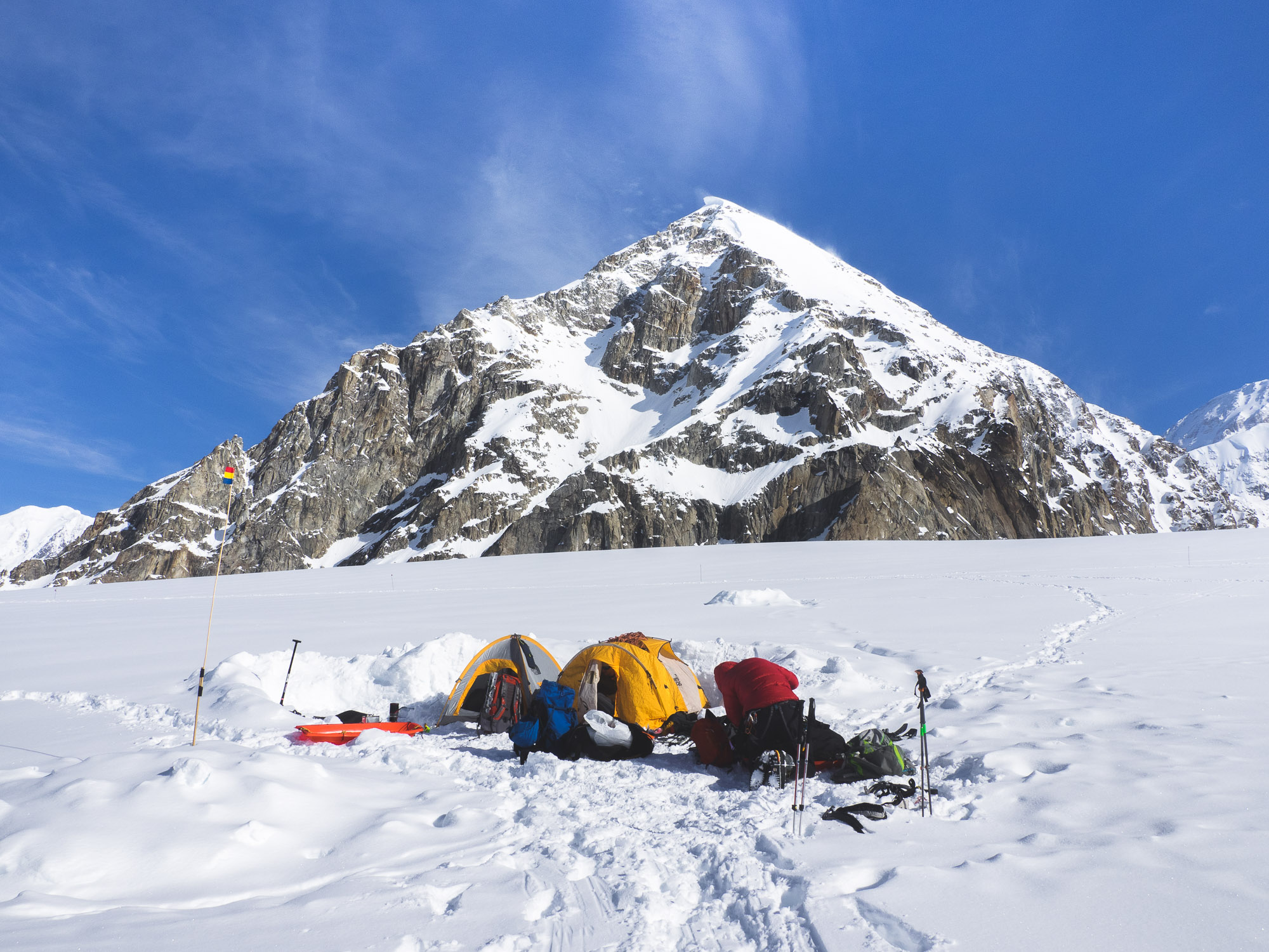
We got our gear sorted and packed in the Sheldon hanger. It was the most gear I’d ever dealt with for a trip by far—about 115 pounds per person. Too much gear it seemed. But we couldn’t throw any of it out because we really didn’t know what we would actually need. We had never done anything like this before. Dave, our pilot, told us we wouldn’t be flying out today. Time to settle in for the night.
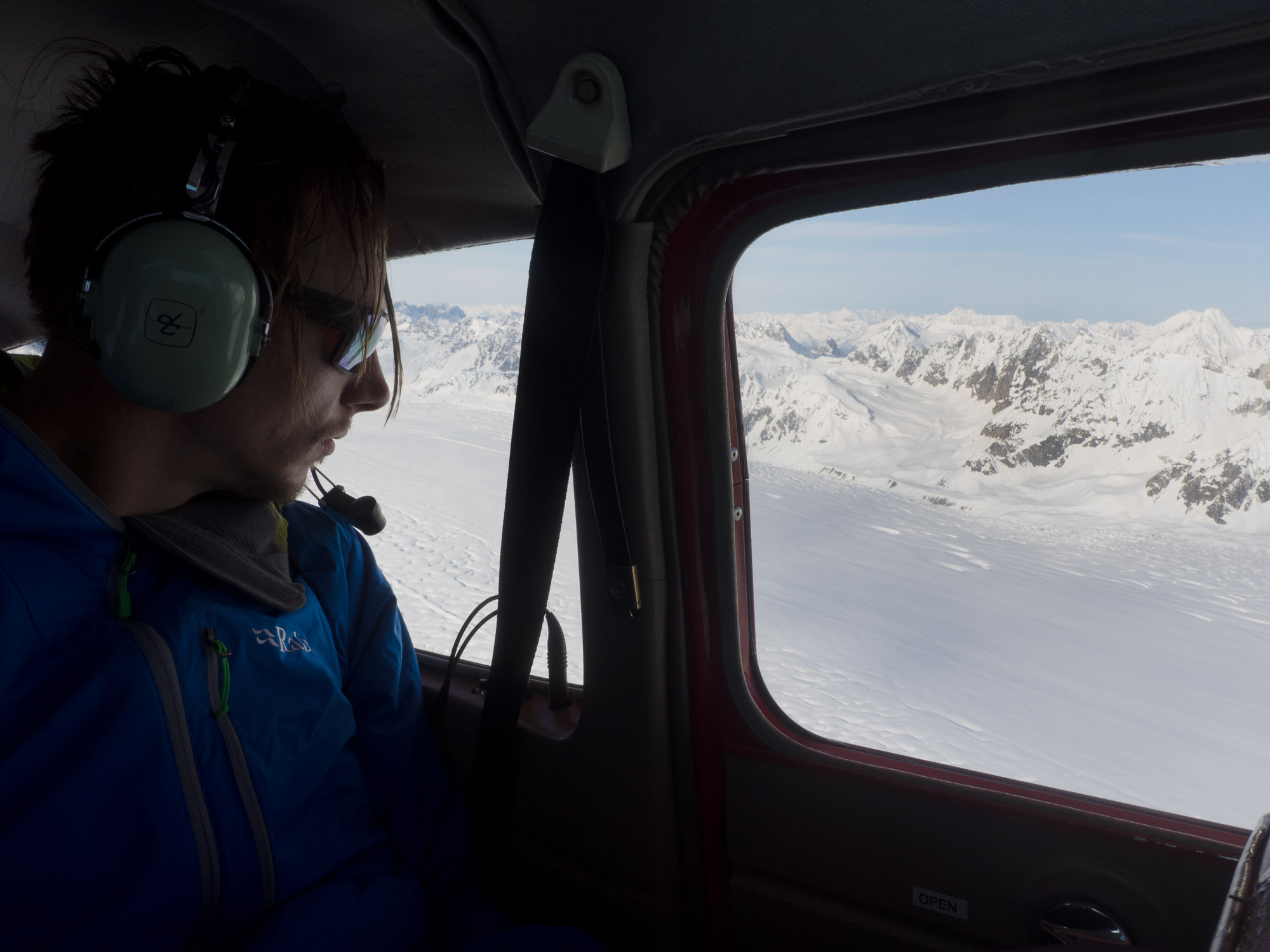
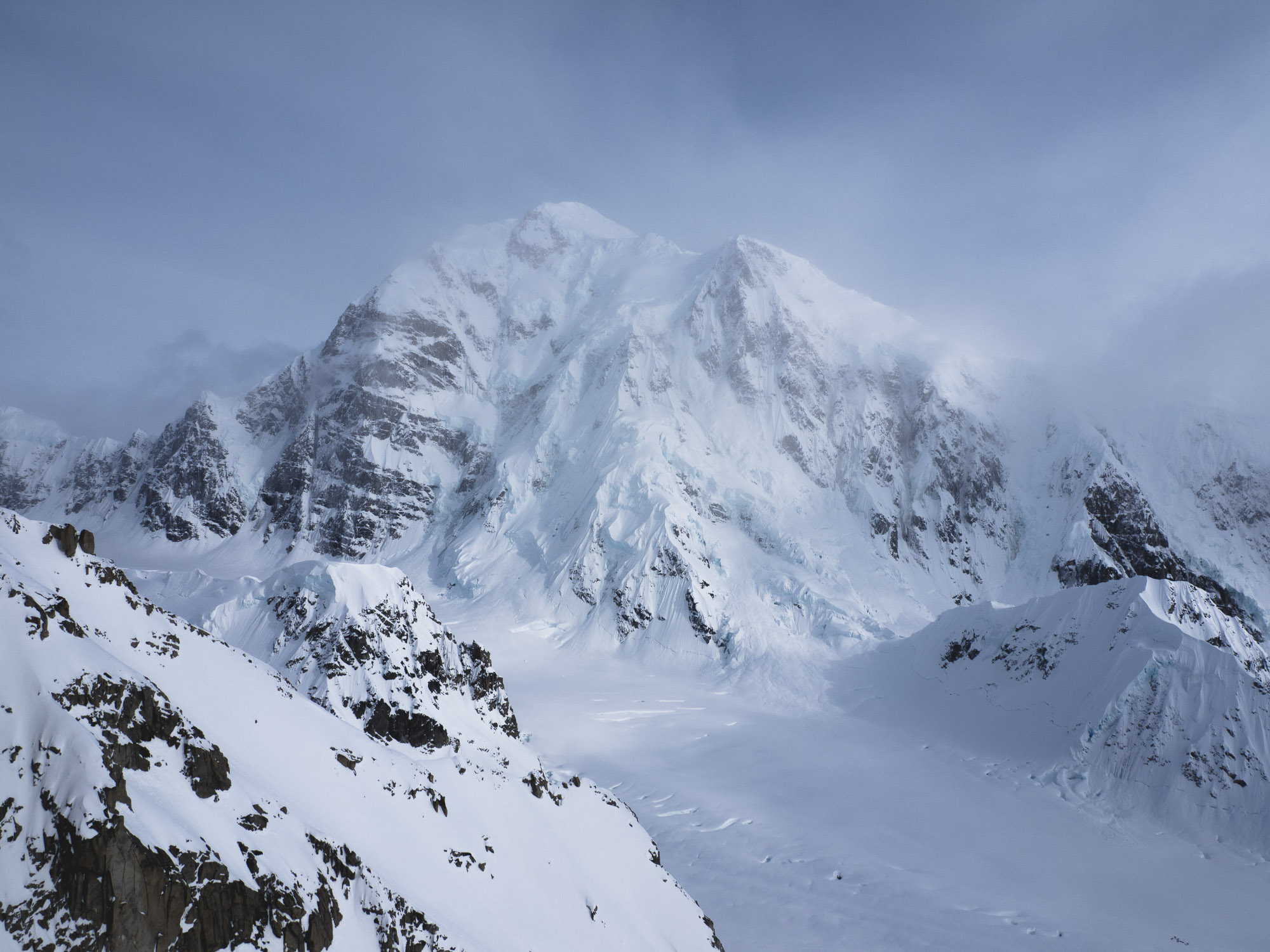
It was clear the next morning. Time to fly in. Dave’s plane was big enough for the three of us, our gear, and Dave. Nothing more. After he strategically loaded our 350 pounds of equipment in the plane, we all hoped in and Dave gave us headphones. We rolled around to the runway and took off. In an instant we rose above the trees, the Alaska range spreading immensely across the horizon—the first time we had seen it clearly. Holy shit it was huge and we were headed right toward it.
Dave dropped us off on the glacier the next day, a Monday morning, May 2, 2016. It was sunny, but the cold morning air hit us. Shit, it’s cold, and we’re only at basecamp, I thought. The sun warmed the glacier up a bit and after we set up camp we immediately left for the base of the Southwest Ridge of Mt. Frances—our “warm up climb.” We knew that you needed an early start but we left halfway through the day anyway. We were ready to climb. The climb was pretty big—3600 feet—and technical, but we were too excited to sit around. We could always bail, or so we thought.
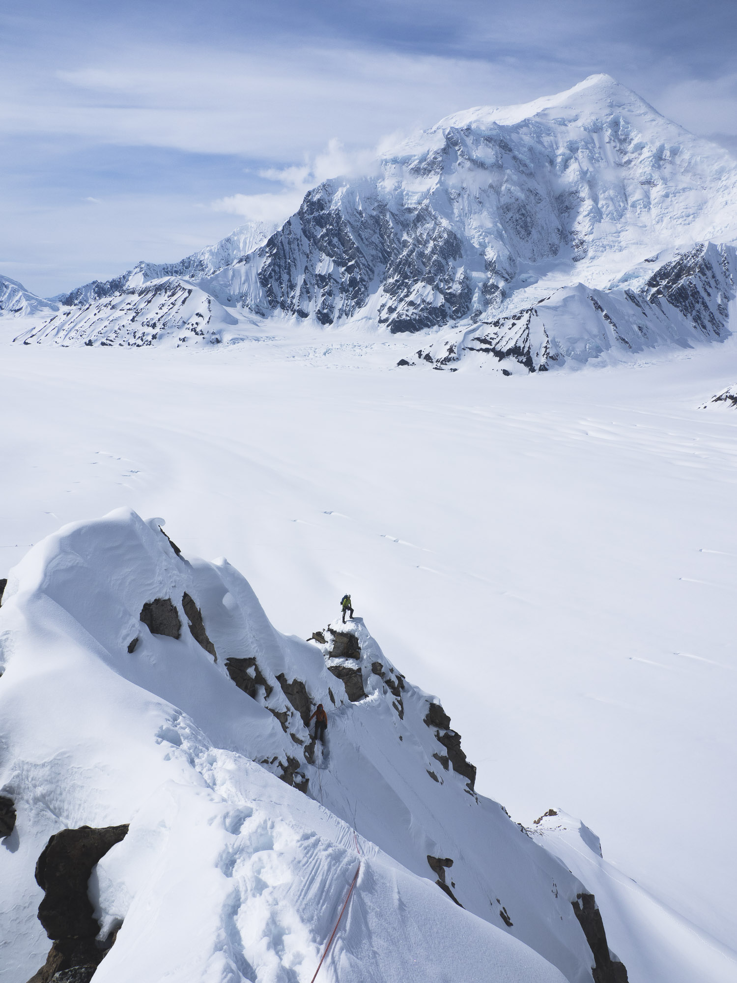
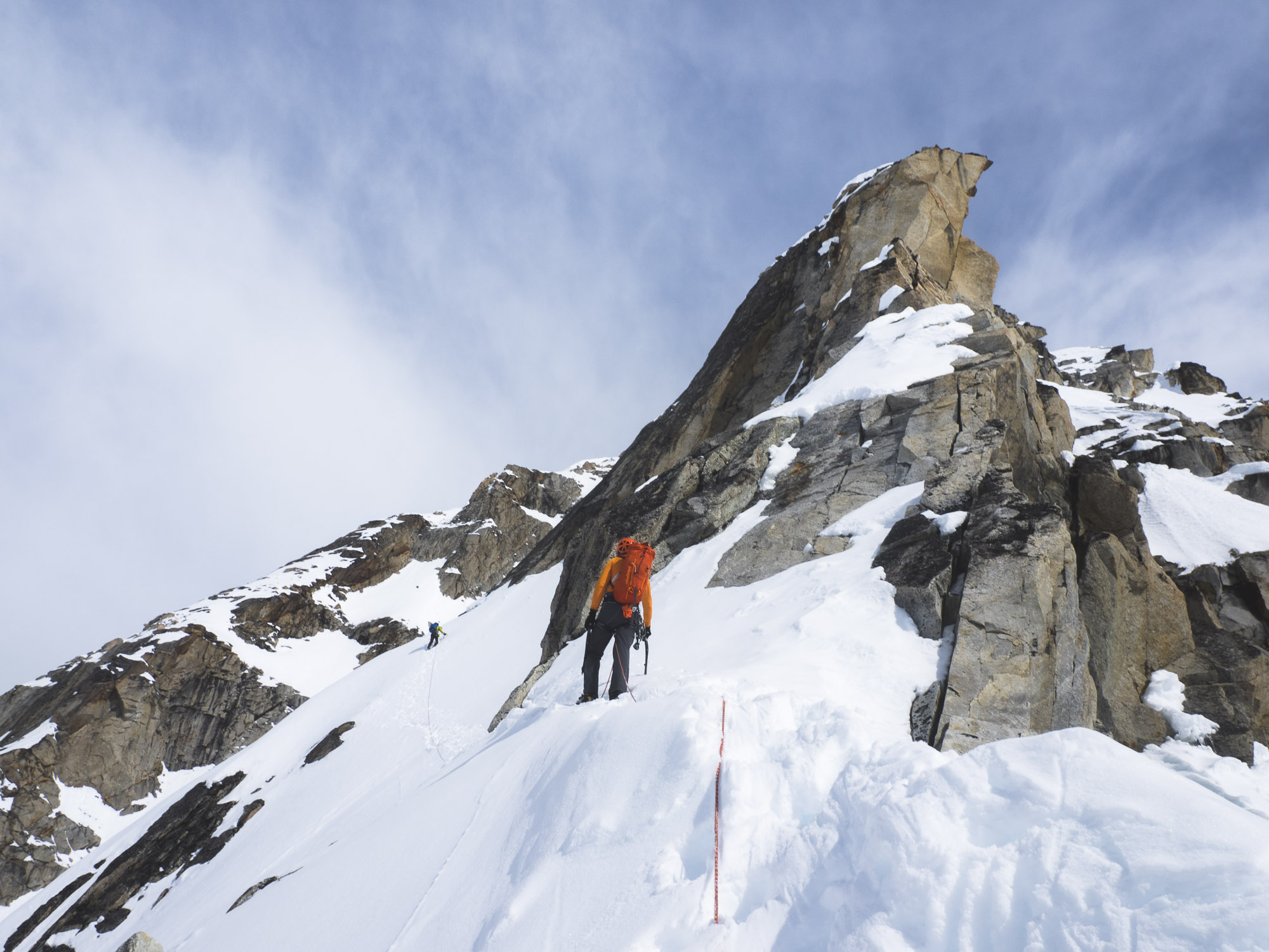
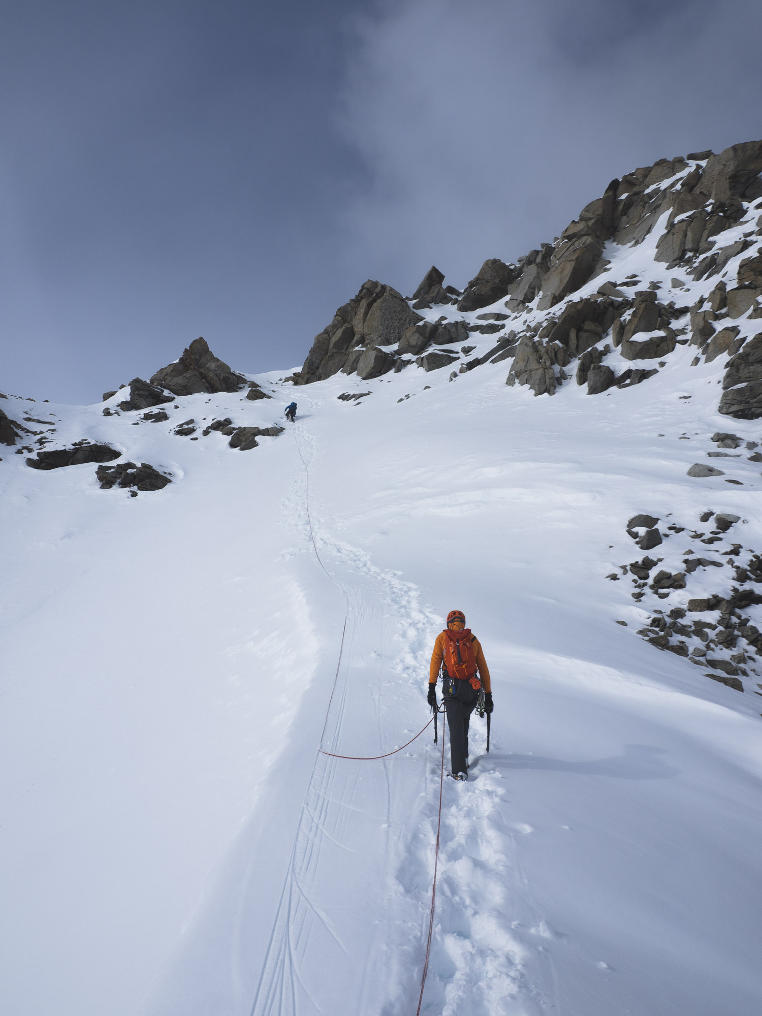
We simul-climbed all the way to the false summit, only 400 vertical feet from the true summit, in seven or eight hours. Matt and I alternated leads six times with Brendon always climbing in the middle. I took most of harder rock portions and Matt took most of the harder snow portions. We simuled right through the 5.7-5.8 mixed rock cruxes pretty easily in our big boots and crampons. We moved fast and it felt good, though the length was beginning to worry me. It was about time to be on top, but the ridge kept going and going until we hit the false summit cornice. Clouds moved in, the visibility diminished, and it started snowing. Moving under the huge cornice—an overhanging mass of hardened snow—I couldn’t help but imagine it collapsing and swiping us off the mountain to the glaciers 3000 feet below.
I was pretty sure we needed to get around the cornice to the right, but Matt saw a boot track leading up to the left.
“Are you sure we should go right?” Matt yelled. I thought about it for a second and remembered seeing photos of climbers moving to the right when they reached the cornice, but in my anxiety I questioned myself. Why was there a boot track up to the left?
“OK, let’s try to the left,” I caved. We traversed across a small ledge above a steep snow slope above a cliff that I couldn’t see the end of. The cornice was overhanging above us. There’s no relief, I thought. I put in my last ice screw and realized I needed more, so I had Brendon and Matt join me on a wider portion of the snow ledge so I could get more gear. Matt was freaking out and wanted to turn around. Brendon and I, more internal compared to Matt, were trying to keep it together.
“Let me check it out a little farther,” I said. Brendon agreed and Matt was out-numbered. I walked a few steps and peered over an edge. The snow ledge disappeared. We would have to turn directly into the cornice, facing it, and traverse its near vertical ice face to continue.
“How does it look?” asked Matt.
“Not good.”
“Ok, we’re turning around.” Matt turned around and blasted back toward the snow slope.
“Wait, Matt, you should take these screws and a picket,” I yelled.
“They won’t do anything.”
He was probably right, but even suspect protection gave me some peace of mind. Again I was imagining sliding off the mountain. I can’t be doing stuff like this. I thought of Liz and shivered.
We weren’t going to try going around the cornice to the right. We were done. Our morale was gone. The weather was deteriorating. It was snowing and getting dark. It wasn’t fun anymore. We just wanted to get off safely, even though we were close to the summit. Instead of going back down our route, we down-climbed a 2500-foot couloir and hoped it wouldn’t slide. We stayed rope together so we could find each other if it did. Eventually we were down and back to our tents after 12 hours of non-stop climbing. A nice warm-up, we thought. Welcome to the Alaska Range. Now, onto the real climbing…
Archive
2023
Dreefee and Crystal Dawn
Rubbernecker
2022
Long's Peak Diamond
Seattle Design Festival Interview
Seeing Circuits: an Interview with the Bouldering Project
2020
Vanishing Point 2.0: A Classic Route Modernized
Interview with Steven Dimmitt
Training Using Circuits
Cuba
2019
Dark Side of Liberty
The Bugaboos
Blue Jeans Direct: The End of the Canadian Rockies Ticklist
The Path
The Shining Uncut
Castles in the Sky
Scarface
Index's First 5.14
Turkey
2018
Patagonia
2017
Dark Side of the Valley
Vanishing Point
Winter Climbing
First Route in the Alaska Range
New York Gully